Among five straits of the Japan Sea the Nevelskogo strait is investigated mostly poor. Usual views are the next. Water inflow in the Sea occurs only in Tsushima strait. And outflow is through Tsugaru and LaPerouse straits only. At conditionally inflow = 100% (in reality it is from 1 up to 4 Sv), outflow through Tsugaru strait (by different estimations) is 67-75%, and the rest (25–33%)—through LaPerouse strait. In calculations the water transport through Nevelskogo is neglected usually because of its insignificant depth and width.
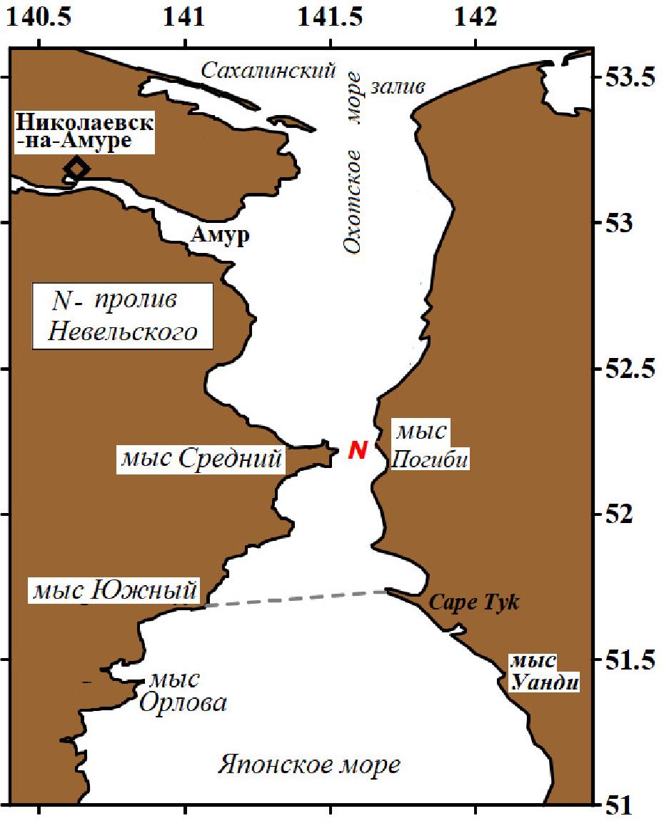
The sill depth (7 m) and width (4 km) of this strait is less than sill depth and width of the other straits (except for Simonoseki strait). From 7.5 km of the width it is possible to remove the length of a dam near continental coast and extensive shelf near Sakhalin. The maximal depth to the south of strait reaches 20 m, but in strait itself—not more than 7 m. But for study of distribution of the polluted Amur river water, the knowledge of the water transport and sea currents direction in the strait are very important.
In a basis of existing views on currents and water transport the analysis of short-term measurements of currents lays (Belinskiy, 1950; Yakunin, 1975). By them, in the strait in summer water transport from the Japan Sea into Amur liman, and in winter—the contrary prevail. But in the same time in narrow and shallow strait both in summer and winter on a vertical two opposite directed currents are allocated. Volume of water transport is estimated in 10-3 Sv. Taking into account the large (2 m) level variations, such views on currents are represented doubtful ones. Such views are caused by short (1-7 days) duration of old measurements of currents.
The analysis of these (winter of 1970 and summer of 1973) measurements of currents, and also other measurements (winter of 1936, summer of 1972 and 5-years old) has allowed differently to estimate currents and water transport in the strait.
Basic conclusions of our investigation:
- The current in a strait is homogeneous on a vertical (barotropic);
- Tidal currents (with 12h period) pass along an axis “southwest–northeast”;
- The duration of water transport in one direction reaches 3 day, and average speed of current is 40 (near the bottom)—60 (at the surface) cm/s;
- Average velocity of southward flow on the is much greater, than of northward one; Maximal flow velocity is on the contrary (more than 160 cm/s in north direction);
- The residual current changes its direction at the end of July (with approach of a short-term summer): before it the northward water transport prevails, and after it–southward one prevails.
- The average northward water transport (1.8*10-2 Sv) and southward one (1.2*10-2 Sv) are on the order higher of determined before.
Straits of the Japan Sea
| Strait | Width, km | Hmin, m | In(+) out(-) |
|---|---|---|---|
| Shimonoseki | 2 | 11 | ? |
| Nevelskogo | 7.5 | <20 | +/- |
| LaPerouse | 44 | <45 | +/- |
| Tsugaru | 19 | 130 | +/- |
| Tsushima | 160 | 125 | + |
It is interesting that By Russian Sailing directions Nevelskogo strait is situated OUT off the Japan Sea (in Amurskiy Liman belonged to the Okhotsk Sea).
FERHRI data center has the data base of oceanographic observations in Amurskiy Liman area.
Between them there are data of measurements of currents.
First of them were got from “bottle post.”
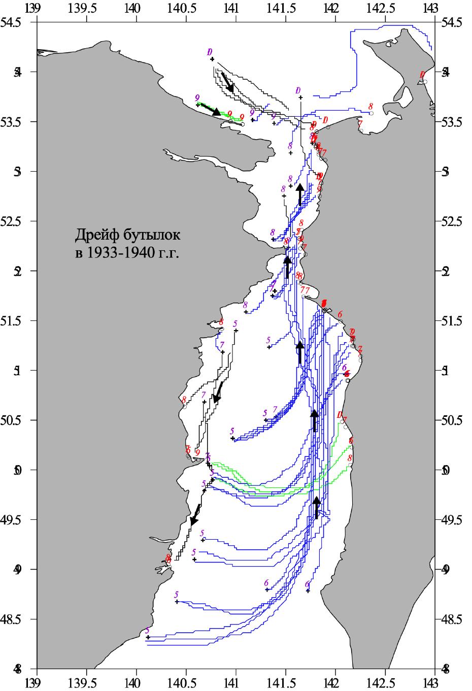
SUMMER BOTTLE POST EXPERIMENTS IN THE PAST
In 1907-1938 prevailed northward water transport through the strait was revealed by drift of bottles.
SUMMER FERHRI MEASUREMENTS
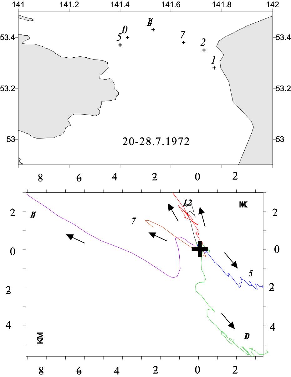
In Sakhalin bay direction and speed of currents were got from short (up to 7 days) measurements. Direction of prevailed currents was different in western (to the southeast) and in eastern (to the north and northwest) its parts. Bottom figure—progressive vectors of different stations. Their position showed at upper figure.
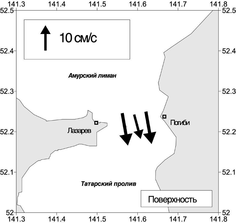
In winter surface (below ice) current was directed to the south at whole strait width.
The same flow was revealed near bottom.
By short-term measurements of currents (Yakunin, 1975) water transport from the Japan Sea into Amur Liman in summer, and in winter—the contrary—prevail. Both in summer and in winter on a vertical two opposite directed currents were allocated. Volume of water transport was estimated as about 10-3 Sv. From our point of view (taking into account small size of the strait and the large (2 m) level variations) such views are doubtful.
SUMMER AND WINTER MEASUREMENTS
Instead of one-way water transport showed in the strait in the past, combined (2-ways as in summer as in winter) water transport was revealed in 70-th on the base of short-term (up to 7 days) measurements.
LAST LONG-TERM MEASUREMENTS
Long-term measurements of currents in the strait were made in summer months. Levels—3, 10 and 17 m. On this data, progressive vectors (chain of measured) were constructed.
CONCLUSIONS
- The current in strait is homogeneous on a vertical (barotropic);
- Tidal currents (12h period) pass along an axis SW-NE;
- Duration of water transport in one direction reaches 20 days;
- Average direction determined by short-term measurements could be wrong;
- Its averaged speed is 40 (bottom)–60 (at the surface) cm/s;
- Average speed of southward flow is much greater of northward one;
- Max (>160 cm/s) speed is typical for the flow to the North;
- The residual current changes its direction at the end of July (with approach of a short-term summer): before it the northward water transport prevails, and after it- southward one.
- The average northward water transport (1.8*10-2 Sv) and southward one (1.2*10-2 Sv) is about 10 times higher of one determined before.